
Leading LiDAR company offering precise data processing for diverse industries with high-speed, high-density capabilities.

Utilizing LiDAR technology for accurate location determination and elevation data across various sectors.

RSI Softech excels in both airborne and terrestrial/mobile LiDAR processing, ensuring satisfaction and quality results.
From site analysis to spatial data management, the types of LiDAR Data Processing services available are diverse and can be tailored to meet the unique needs of various industries and applications.

Cadastral mapping is a record of the details related to the properties in an area. The cadastral mapping services used to create the maps make it simple to handle public land records. National and local governmental bodies, real estate developers, architecture, engineering firms, and industries make proactive use of cadastral mapping services for making better decisions.
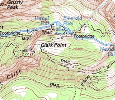
Industries are helped by topographical mapping when it comes to choosing the most efficient route from one location to another. To better understand an area's elevation, topographical mapping uses contour lines to map the topography. Topographic maps are utilized in a variety of applications, including energy exploration, resource conservation, public works design, environmental management, and commercial and residential development.

Parcel mapping is a technique for creating land parcels using GIS data for efficient and accurate land management. Parcel maps are utilised in various implementations in various industries like land administration & land registration by urban and rural governing agencies. Municipality planning & urban development. At Polosoft, we develop the parcel map with the highest accuracy.

Indoor mapping makes it easier for industries to navigate from one point to another within a building premise. The usage of indoor mapping prevents the user from becoming lost and confused inside a large, complicated building. With the development of IoT-enabled smart buildings, Polosoft creates multidimensional digital maps by superimposing various data layers to create scalable, location-aware apps

Geographic information systems, or GIS, are widely used by the utility industry for remote sensing utility mapping services and computer-aided design, or CAD and drafting technologies, for efficient operation. With years of experience, Polosoft Technologies offers specialized and effective GIS services for various utility industries , including electricity, water, gas, sewage, and telecom.

Geological mapping, which is based on an integrated analysis of satellite, geochemical, and geophysical data, provides early information about bedrock geology, assisting geologists in their planning before fieldwork. Polosoft Technologies has a wealth of experience in delivering GIS services to the mining industry as well as businesses and industries involved in excavation and mineral management.

LULC stands for Land Use Land Cover. GIS mapping includes land cover mapping, which gives specialists and professionals access to local information for comprehending the current landscape. National spatial databases with annual LULC data make it simple to track temporal dynamics in places like agricultural ecosystems, forest conversions, surface water bodies, etc.

This is the graphic depiction of the chosen basic map data, scaled according to a predetermined scale, from which additional mapping data of a more specialized kind can be assembled. In order to create intelligent GIS maps, base mapping is useful for understanding infrastructure, land bases, utility networks, property data, etc. Accuracy is guaranteed by Polosoft Technologies’ methodical base mapping process.

The major data format for editing and data management is the geodatabase, which is the native data structure for GIS mapping. Polosoft works with geographic data in a variety of GIS file formats created to cooperate with and make use of the geodatabase's features. A geodatabase is a database created specifically for the storage, querying, and manipulation of spatial and GIS data conversion.

The term "geo-referencing" describes the internal coordinate system of a digital map or aerial photograph that is/can be connected to a geographic coordinate system on the ground. Assigning positions to geographical objects within a certain geographic frame of reference is known as georeferencing. It is essential to geospatial technology, specifically GIS.
GIS Map digitization is representing an analog signal or an image using a discrete set of its points. After conversion, the data is in the form of binary codes, which the computer can read and understand instantly. Text, images, audio, and video are all examples of converted data. As spatial data, the x and y coordinates are noted and saved.

The conversion of inferred data from one format to another is referred to as GIS data conversion. Converting data from a big volume of obtained GIS data is simpler than completely constructing the data from scratch. The change and transfer of data between various systems is a crucial step in the migration of information from existing databases.
.png)
.png)
.png)
.png)
.png)
.png)
.png)

.png)
.png)
.png)
.png)
.png)
.png)
As a prominent LiDAR company, RSI Softech plays a crucial role in LiDAR classification, offering specialized, professional LiDAR services to clients worldwide. Our services span aerial, mobile, and drone LiDAR, continuously expanding to cater to diverse industries like forestry, transportation, flood mapping, and environmental management.
Our expert teams quickly grasp new project requirements, ensuring timely and efficient delivery through rigorous quality checks. Connect with us via email to explore our services.

Data processing is simply considered the manipulation of data using a computer. It may include conversion of acquired raw data to machine-readable form, flow of data through the CPU and memory to output devices, and formatting or transformation of output.
LIDAR is a technology which will embark nations on the journey to the future. It enables data capture on the field by lighting the target using a pulsed laser. As it's also used for providing precise and perfect elevation data, it finds several applications across industries.
LIDAR data acquired from airborne sensors from satellites or drones or more are available through The National Map Download Client. These data have completely discrete-return, classified point-cloud data provided in LAS format for users.
LIDAR data processing helps in examining both natural and manmade environments. Activities such as inundation and storm surge modeling, hydrodynamic modeling, shoreline map emergency response, hydrographic surveying, and coastal vulnerability analysis are way easier with LIDAR data processing.
Translation between other data formats Combining point clouds with other formats Inspection of point components and values Tipng the data to speed up processing time Reducing the number of points.